Charts
Here is an introductory video on the subject of "Charts" in AvNav.
Formats
AvNav supports various chart formats, for example:
Raster charts
Formats: GEMF, MBTiles and PMTiles
Freely available raster charts are provided by sources such as OpenSeaMap and FreeNauticalChart. Raster charts from various sources can also be created manually and uploaded to AvNav or generated using the Mapproxy app. More details on this can be found in the details. Using the tool Mobile Atlas Creator charts from various online sources can be downloaded and subsequently installed in AvNav. Information on this can be found under Mobile Atlas Creator. You can also find other tools on the internet that enable the downloading of charts.
Vector charts
AvNav primarily uses vector charts from O-Charts with the appropriate plug-in. With O-Charts, all common maritime areas in Europe can be covered at affordable prices. They are based on official charts from the respective countries and contain all the information required for navigation with pleasure craft. Unfortunately, O-Charts do not run on Windows systems.
In addition, vector charts of inland waterways in iENC format and vector charts from NOAA can be downloaded free of charge.
Online chart sources
These charts require an internet connection. This would be, for example, OpenSeaMap again in the online version without prior download.
Plugins
With the appropriate plugins, additional chart formats, such as vector tiles, can be used. However, this requires some preparatory work. You can find further support for this in the details.
Management
With the installation of AvNav, several charts, e.g., from the BSH or OpenSeaMap, are already provided. You can reach the overview of existing charts directly from the navigation page via the button. Using the "Select Charts" dialog, you can see all already installed charts.
In the area
->
you can manage the charts.
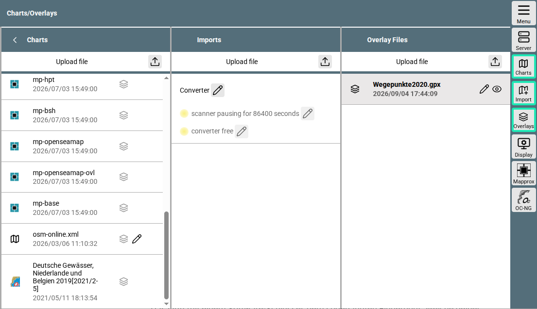
Charts page
Here, too, you can see the already installed charts in the "Charts" column.
Via "Upload File" in this column, you can upload charts in the supported formats to the AvNav server.
The "Import" column is intended for charts that need to be converted beforehand. You can read about how this process works in detail in the details.
And the right column “Overlays” is described in a separate chapter.
In the button bar at the bottom, you will see the OC-NG button
 .
It is responsible for the installation of O-Charts. In the Video the installation of O-Charts is shown; for further reading, you can use the detailed documentation.